|
The village of Le Hinglé is a small village located north west of France. The town of Le Hinglé is located in the department of Côtes-d'Armor of the french region Bretagne. The town of Le Hinglé is located in the township of Dinan-Ouest part of the district of Dinan. The area code for Le Hinglé is 22082 (also known as code INSEE), and the Le Hinglé zip code is 22100.
Geography and map of Le Hinglé :
The altitude of the city hall of Le Hinglé is approximately 70 meters. The Le Hinglé surface is 3.37 km ². The latitude and longitude of Le Hinglé are 48.393 degrees North and 2.078 degrees West.
Nearby cities and towns of Le Hinglé are :
Trévron (22100) at 1.23 km, Bobital (22100) at 2.84 km, Saint-Carné (22100) at 2.85 km, Brusvily (22100) at 3.42 km, Calorguen (22100) at 4.15 km, Saint-Juvat (22630) at 5.06 km, Plumaudan (22350) at 5.12 km, Trélivan (22100) at 5.32 km.
(The distances to these nearby towns of Le Hinglé are calculated as the crow flies)
Population and housing of Le Hinglé :
The population of Le Hinglé was 680 in 1999, 846 in 2006 and 855 in 2007. The population density of Le Hinglé is 253.71 inhabitants per km². The number of housing of Le Hinglé was 352 in 2007. These homes of Le Hinglé consist of 325 main residences, 7 second or occasional homes and 20 vacant homes. |
|
|
Hotel Le Hinglé
|
|
|
Book now ! Best Price Guaranteed, no booking fees, pay at the hotel with our partner Booking.com, leader in online hotel reservation.
Find all hotels of Le Hinglé : Hotel Le Hinglé
| |
|
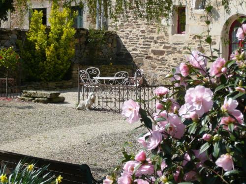
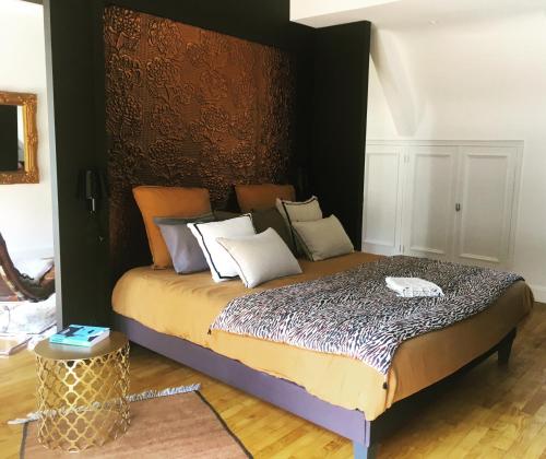
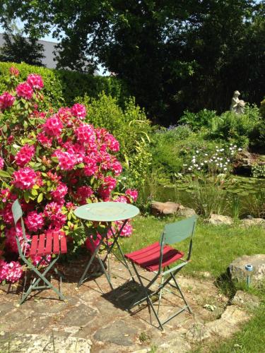
Guest accommodation : DINAN Gîte "La Priquetais"

Offering free WiFi and garden views, DINAN Gîte "La Priquetais" is an accommodation set in Le Hinglé. Guests staying at this holiday home have access to a fully equipped kitchen...
Address : La Priquetais 22100 Le Hinglé
Distance Guest accommodation - Le Hinglé : 1.08 km
|
|
|
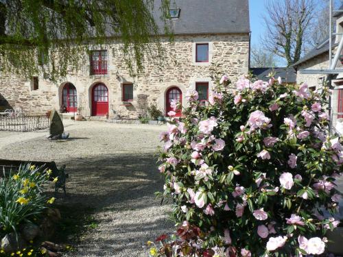
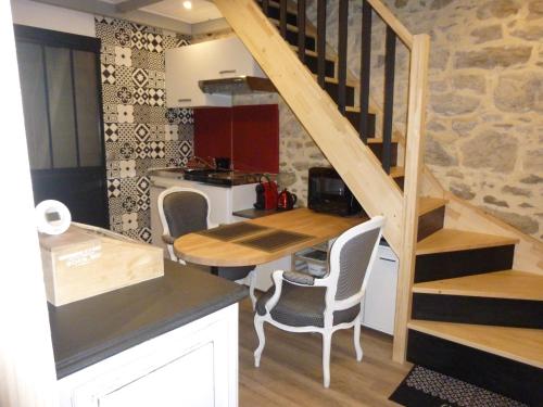
Bed and Breakfast : B&B DINAN la priquetais
Set in a 1 hectare park in Trévron, 10 km from Dinan, La Priquetais boasts a terrace and views of the garden. Free WiFi is available throughout the property and free private par...
Contact : lieu dit "la priquetais" 22100 Trévron
Distance Bed and Breakfast - Le Hinglé : 1.11 km
|
|
|
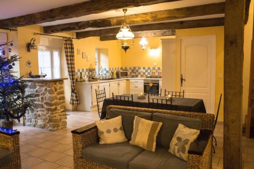
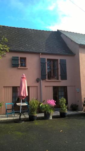
Guest accommodation : Gite Hortensias
Gite Hortensias is located in Trévron and offers a garden, a terrace and a shared lounge. This holiday home also features free WiFi. The holiday home is composed of 3 bedrooms,...
Contact : 21 Rue de la Mare 22100 Trévron
Distance Guest accommodation - Le Hinglé : 1.17 km
|
|
|
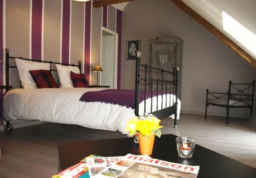
Bed and Breakfast : Chambres d'hôtes Dinan
Situated in Trévron, Chambres d'hôtes Dinan features free WiFi and units equipped with a kitchen and terrace All units are fitted with a dishwasher, oven, a coffee machine, a m...
Contact : 19 rue de la mare 22100 Trévron
Distance Bed and Breakfast - Le Hinglé : 1.19 km
|
|
|
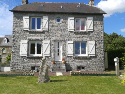
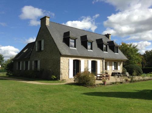
Guest accommodation : Villa Louisa

Featuring free WiFi throughout the property, Villa Louisa offers accommodation in Bobital, a 9-minute drive from Dinan centre and a 36-minute drive from Saint Malo. Guests can e...
Price : from 119.00 €
to 159.00 €
Address : lieu dit Notre Dame 66 route des granits 22100 Bobital
Distance Guest accommodation - Le Hinglé : 2.02 km
|
|
|
Guest accommodation : Le P'tit Cottage
Set in Saint-Carné in the Brittany region, Le P'tit Cottage has a balcony. Guests staying at this holiday home have access to free WiFi and a fully equipped kitchen. The holida...
Prices : from 58.00 €
Contact : 8 rue de l'Eglise 22100 Saint-Carné
Distance Guest accommodation - Le Hinglé : 2.72 km
|
|
|
Guest accommodation : Les trois cheminees
Les trois cheminees is located in La Bagrie, a quiet hamlet of 6 houses about 10km from Dinan and 25 km from Dinard. There is a fully equipped kitchen and living room/dining ar...
Contact : la bagrie les trois cheminees 22630 Saint-Juvat
Distance Guest accommodation - Le Hinglé : 3.16 km
|
|
|
Guest accommodation : Le Dragon
Le Dragon is a country house set in Plumaudan, 13.5 km from Dinan and 46 km from Saint Malo. You can relax by the seasonal heated pool in the garden and make use of the barbecue...
Contact : 52 La Touche 22350 Plumaudan
Distance Guest accommodation - Le Hinglé : 3.72 km
|
|
|
Bed and Breakfast : L'Hermine Blanche
L'Hermine Blanche is located in Calorguen and offers a garden. This bed and breakfast also has free WiFi. Offering direct access to a terrace, the bed and breakfast consists of...
Prices : from 78.00 €
Address : 15 Route de Dinan 22100 Calorguen
Distance Bed and Breakfast - Le Hinglé : 4.14 km
|
|
|
Bed and Breakfast : La Vie là Rose
Located in Léhon in the Brittany region, La Vie là Rose has a terrace. The accommodation is 38 km from Saint Malo. The bed and breakfast is fitted with a TV. A continental bre...
Rate : from 75.00 €
to 95.00 €
Contact : 12 Route de Saint-Carné 22100 Léhon
Distance Bed and Breakfast - Le Hinglé : 4.60 km
|
|
Find another hotel near Le Hinglé : Le Hinglé hotels list
|
Map of Le Hinglé
|
|
Map of Le Hinglé :
At right you can find the localization of Le Hinglé on the map of France. Below, this is the satellite map of Le Hinglé. A road map, and maps templates of Le Hinglé are available here : "road map of Le Hinglé". This map show Le Hinglé seen by the satellite of Google Map. To see the streets of Le Hinglé or move on another zone, use the buttons "zoom" and "map" on top of this dynamic map.
Search on the map of Le Hinglé :
To search hotels, housings, tourist information office, administrations or other services, use the Google search integrated to the map on the following page : "map Le Hinglé".
Hotels of Le Hinglé are listed on the map with the following icons: 
The map of Le Hinglé is centred in the following coordinates :
|

|
|
|
|
Print the map of Le Hinglé

Print the map of Le Hinglé : map of Le Hinglé
|
Photos Le Hinglé
|
See all photos of Le Hinglé :
Other photos of Le Hinglé and nearby towns can be found here: photos Le Hinglé
|
|
Le Hinglé weather forecast
Find next hours and 7 days weather forecast for Le Hinglé here : weather Le Hinglé (with english metrics)
This is the last weather forecast for Le Hinglé collected by the nearest observation station of Dinan.
Week Forecast:
The latest weather data for Le Hinglé were collected Friday, 31 July 2026 at 08:02 from the nearest observation station of Dinan.
| Friday, July 31st |
22°C 16°C
0%
55%
|
Partly cloudy
Temperature Max: 22°C Temperature Min: 16°C
Precipitation Probability: 0%
Percentage of sky occluded by clouds: 55%
Wind speed: 18 km/h South
Humidity: 57%° UV Index: 4
Sunrise: 06:41 Sunset: 21:47 |
|
| | Saturday, August 1st |
22°C 13°C
0%
68%
|
Mostly cloudy
Temperature Max: 22°C Temperature Min: 13°C
Precipitation Probability: 0%
Percentage of sky occluded by clouds: 68%
Wind speed: 14 km/h South
Humidity: 59%° UV Index: 4
Sunrise: 06:42 Sunset: 21:45 |
|
| | Sunday, August 2nd |
27°C 13°C
0%
72%
|
Mostly cloudy
Temperature Max: 27°C Temperature Min: 13°C
Precipitation Probability: 0%
Percentage of sky occluded by clouds: 72%
Wind speed: 11 km/h Sout-East
Humidity: 54%° UV Index: 5
Sunrise: 06:43 Sunset: 21:44 |
|
| | Monday, August 3rd |
29°C 17°C
0%
55%
|
Partly cloudy
Temperature Max: 29°C Temperature Min: 17°C
Precipitation Probability: 0%
Percentage of sky occluded by clouds: 55%
Wind speed: 9 km/h South-East
Humidity: 54%° UV Index: 5
Sunrise: 06:45 Sunset: 21:42 |
|
|
Attribution: 
|
|
Other maps, hotels and towns in france
Find another town, zip code, department, region, ...
Quick links Le Hinglé :
Make a link to this page of Le Hinglé with the following code :
|
|
|
 French Version : http://www.cartesfrance.fr/carte-france-ville/22082_Le Hingle.html


